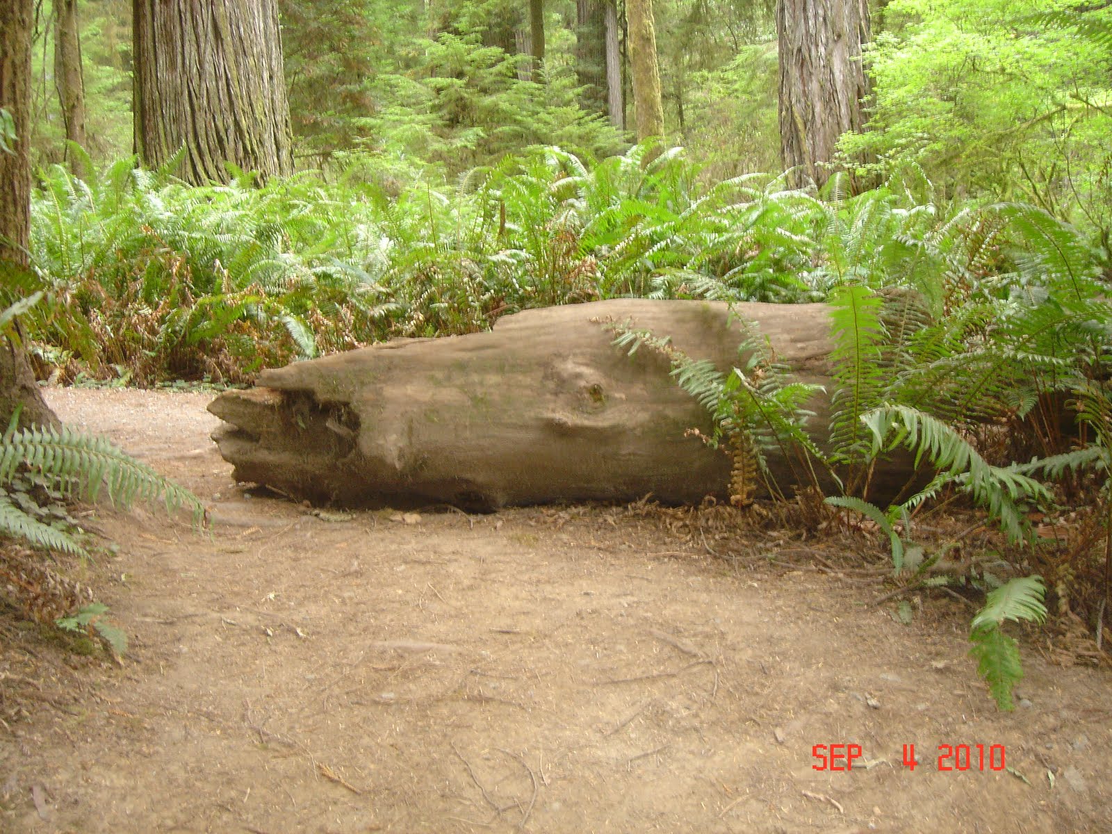
As we walked around the Redwood National Parks, I could not help myself. I had to take pictures of the images I saw in the woods. I was a child all over again excited with my imagination and anticipation of what I might find. Do you see what I see???? Click on each picture to get a larger view. Please let me know what you see using a comment post!!!!!!
Monday, September 6, 2010
Do You See What I See???
As we walked around the Redwood National Parks, I could not help myself. I had to take pictures of the images I saw in the woods. I was a child all over again excited with my imagination and anticipation of what I might find. Do you see what I see???? Click on each picture to get a larger view. Please let me know what you see using a comment post!!!!!!
Sunday, September 5, 2010
Highway 101 in California
Traveling along Highway 101 was visually beautiful. The Pacific Ocean was gleaming and its waves provided surfers with an opportunity to show off their skills. The coastline here is very different from Maine. It has a lot of cliffs and rocks jutting out from the ocean and on the sand. (Makes you appreciate Goose Rocks Beach even more!!!)
Here is an interesting fact: During World War II, there were "Disguised Houses" placed in the cliffs along the coastline which were actually military observation platforms that were manned and armed in the event of another Japanese attack along our California coast. These disguised buildings looked just like little houses with dormers. If anyone has ever seen the comedy movie 1941 with John Belushi and Dan Ackroyd, you come away with a renewed understanding of the fear that gripped our California neighbors during that time.
The Redwood Forest in California
The Old Growth Redwood Forest is an ancient forest where 1000 year old trees form a canopy over a mixture of hardwood trees, shrubs, and ferns. You will see randomly fallen trees which nurse new life on the forest floor such as hemlock trees, huckleberries, and ferns sprouting among the decaying trunks and branches. New trees often sprout if the original is damaged or cut down. The thick fibrous bark of the Redwood which lacks resin can be several inches thick which protects the tree from fire damage. Numerous fires can eventually weaken the bark thus allowing fire to burn through to the innermost wood and cause the base to become hollow.
Some of the unusual growths on a dead tree are called shelf fungus which work to decompose or breakdown material to provide nourishment for the surrounding plants. Isn't Mother Nature incredible???
Here's an interesting fact: The Redwoods which can be up to 350 feet tall have very shallow roots. The reason is that there is plentiful water close to the ground surface and since water is readily available, these Redwoods do not need a deep root system. These shallow roots, though, make the trees vulnerable to high winds and floods. But the good news is that their roots can spread hundreds of feet from the tree and join with roots from neighboring trees creating a web for extra support. You've got to hand it to Mother Nature again.
Friday, September 3, 2010
A Hiking and A Boating We Will Go.........
In the afternoon, Lee and I (dressed in our hiking gear....yes girls, hiking gear!!!) made our way down the Cleetwood Cove Trail which is the only legal access to the shore of Crater Lake where we were catching a boat tour. For those of you out there who thought I was a wimp just read this information about this hike, and I quote...."The hike is steep and strenuous: in 1.1 miles the trail drops 700 feet in elevation. Walking back up is equivalent to climbing 65 FLIGHTS of stairs." I rest my case. We took the boat tour with Captain Mark and Ranger Stephanie who presented us with a great deal of information about Crater Lake and its surrounding cliffs. The lake has no inlet or outlet streams and is fed solely by springs, snowmelt, and rainfall. Evaporation and ground seepage keep the lake at a nearly constant level. We were able to get very close to Wizard Island with its steep volcanic cone (765 feet high). It was here that we were able to see just how clear the waters were. We learned about the three C's of Crater Lake; Clarity, Cleanliness, and Color. The water is so clean that you can actually drink directly from the lake. The color, of course, has to do with the light refraction( light gets absorbed color by color as it passes through clear water; the last to be absorbed are the blues; only the deepest blue gets scattered back to the surface), and the cleanliness has to do with nature's natural balance and human maintenance. Originally Crater Lake contained no fish. Between 1888 and 1941, however, 6 species were introduced. Today only two types remain: rainbow trout and kokanee salmon. Anyone who fishes at the Lake has to use lures; no live bait is allowed which can affect the ecological system. One of the pictures above, shows some remnants of snow left from the previous winter's snow fall. All in all, the two hour tour was relaxing and visually stunning. There wasn't a cloud in the sky. It was just perfect. I am glad to say that when we returned to shore, the temperature cooled down a bit and the trail back was a little more shaded. It was indeed quite laborious but I am proud to say that we made it. The picture is of me was taken after the hike back. Tt just goes to show you, anything is possible!!!
Crater Lake
Here's a picture of Sammy's first camp fire. It was a chilly first night but we enjoyed sitting and gazing at the fire. Even though Sammy did not pose for this picture, he was indeed in a trance gazing at the flames.
There is so much to talk about Crater Lake that I will have to make two blog entries. This first one is about our scenic drive all around the rim of the lake. As we approached the lake, there is a Pumice Desert which is made up of the orange pumice rock in the area.
Here's a little history: Crater Lake sits inside a caldera formed about 7700 years ago when a 12,000 foot tall volcano, Mount Massuma, collapsed following a major eruption. Later eruptions formed Wizard Island, a cinder cone near the southwest shore. The lake is 1943 feet deep and its annual snowfall is 44 feet. Can you imagine that????
The color of the water is sapphire blue with greener waters closer to the shoreline. By the shoreline, you can actually see bottom even at 150 feet. As we traveled we stopped at Cloudcap Overlook which is the highest point on the rim drive (1790 feet above water). We stopped to see the Pumice Castle which is a layer of orange pumice rock that has eroded into the shape of a medieval castle. We also saw the Phantom Ship which is an island as tall as a 16 story building which resembles a small pirate ship. This erosion resistant rock formation is about 400,000 years old. There's a lot more to tell and I will catch up with you on the next blog.
Wednesday, September 1, 2010
Fog, Fog Go Away!!!!!!!
We woke up to another overcast morning!!!! Our drive today took us back into the mountains where the fog blanketed the tops of the trees. The mist on the road made our drive seem somewhat surreal. It actually was quite romantic driving through deep forests of trees with the mist. It reminded me of some of the novels I've read. We drove through lots of little bridges which Oregon is known for. We saw a herd of Elk in Elkton (it's true, I did not make this up) and some domesticated buffalo. We passed by them so fast that I could not capture them on film. About midday, the skies got brighter and we began to drive more inland where we saw more farmland with horses and cows. The mountainside and landscape began to change as the above pictures show.
We took the Oregon Scenic By Way on Route 138 and beheld some exquisite scenery. We traveled through the Umpqua National Forest where we followed the Umpqua River. We pulled over to take some pictures of this beautiful river cascading over the rocks. The water was so clear that Lee could even spot some fish. I tried to imagine what it must have been like for pioneers to come upon this spot. Whether it was to wash, fish for food, or just relax, it must have been an incredible experience for them.
We finally arrived at our campground (Diamond Lake RV Park) near Crater National Park. Lee went off on a bike ride while I stayed back in the coach to do paperwork (monthly bills, blog, do a wash, etc.) We are planning on having a camp fire tonight which will be great. It will be our first fire since we went on this trip.
Tomorrow we look forward to traveling to Crater Lake and its surrounding areas. We'll keep you posted.
The Rainy Oregon Coast
We woke up to a very rainy day so we eased into our morning. The last park we traveled through in Washington was the Lewis and Clark National Historic Park which was surrounded by a coastal rain forest. The trees located here receive very little or no sun and since there they get a lot of rain, the trunks of the trees are covered with patches of moss. Even some of the evergreens located along lakes and ponds had a greenish/yellow mold on its needles.
Well, we said goodbye to Washington state and crossed the Astoria Bridge into Oregon. The rain was pouring down and the wind was whipping so hard that even the sea gulls was fighting to fly straight.
We passed through quite a few quaint seaside towns called Rockaway Beach, Manhattan Beach, and Miami Cove. Each town had the typical seafood restaurants and tourist shops; very reminiscent of scenic Route 1 in Maine. The limited views of the ocean still presented an awesome sight. The big waves breaking against the shore were amazing. The color of the water and the sky were the same gray color except for the white caps. I am sorry that I was not able to take that many pictures from the coach because of the weather. We unfortunately missed a lot of the coastal water views while we traveled in the mountains. I am sure that tomorrow will be a better day weather wise.
Subscribe to:
Posts (Atom)